A village arranged by the mountain
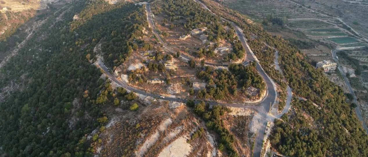
The recommended concept combines terraces and gardens. Development follows the site's form, with villas between landscape layers and a central mixed-use heart positioned around key views.
- Established and re-established terraces
- Villa communities and private gardens
- Central plaza and central park
- Green routes and destination anchors
Terraces and gardens
Liwan Village is zoned as a series of striations across the site. The majority of the built area is dedicated to villas, while a mixed-use centre and open spaces create a shared village structure.
Existing landscape features are treated as part of the plan. Scenic views, topography, rock, vegetation, and established routes guide where development can sit.
- Terrain
Sensitive development follows the form of the topography.
- Built form
Villas sit between layers of gardens and large open spaces.
- Shared heart
The mixed-use centre and central open space occupy a central position.
- Views
Major public uses and architecture are oriented to the mountain context.
 Open full size
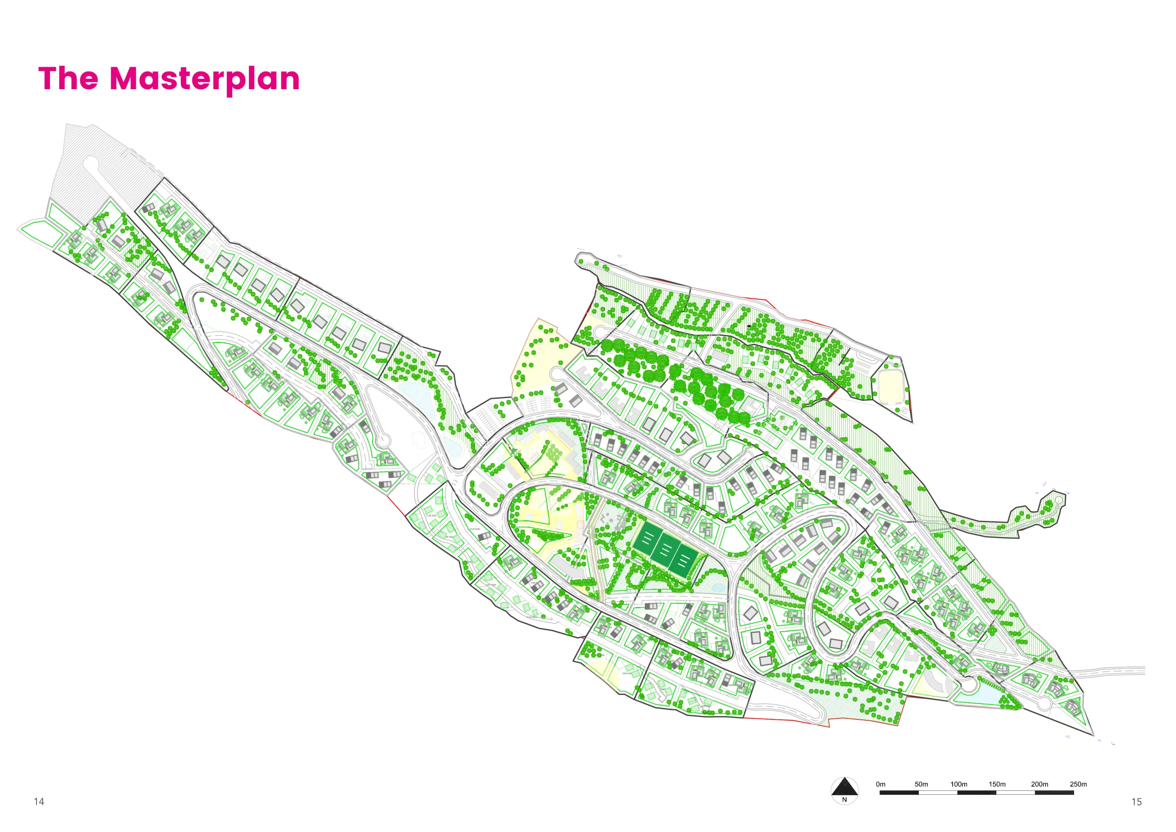
 Villa plots and roads wrap around the central recreation area, with open land and destination uses extending toward the edges of the site.
The plan through its main anchors
These masterplan entries explain the central park, mixed-use plaza, agrotourism area, and equestrian club in more detail.
- 01
Central Park
The central open-space anchor sits beside the mixed-use heart and forms part of a larger network of parks and green routes.
Read component - 02
Mixed-Use Plaza
Retail, hotel, restaurant, and cultural uses gather around a central plaza that includes a renovated historic area.
Read component - 03
Agrotourism Area
Agriculture and chalets occupy a broad outer area of the plan, with cabin typologies studied for smaller-scale stays.
Read component - 04
Equestrian Club
A horse riding and equestrian club forms a landmark at the edge of the agriculture and agrotourism area.
Read component
Read the framework sheet by sheet
Each drawing isolates one system, making the relationship between land use, movement, open space, and architecture easier to read.
The full site plan shows built plots, roads, gardens, open spaces, and the central recreation area across the mountain terrain.
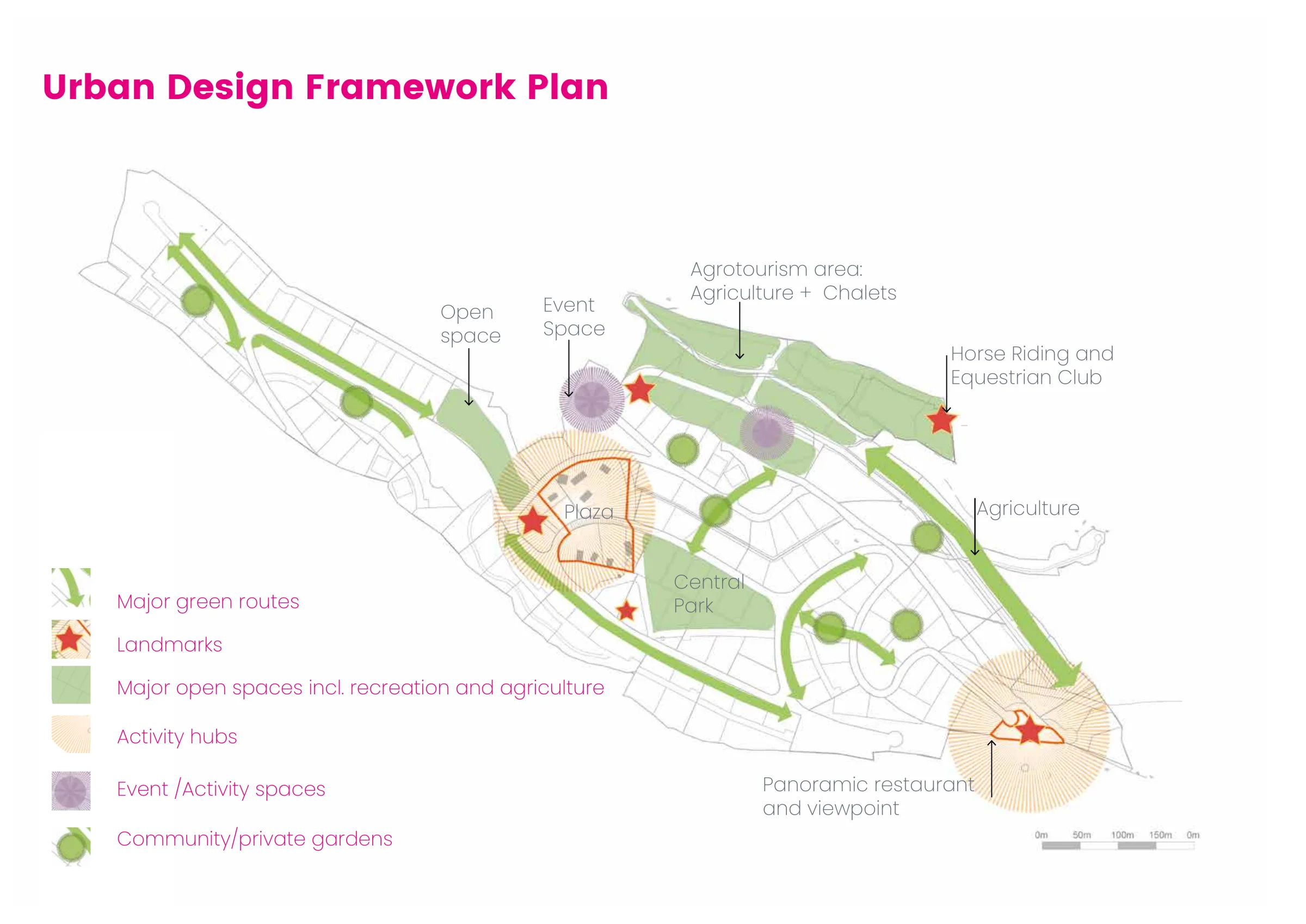
Major green routes connect the plaza, central park, event space, agrotourism, equestrian club, and panoramic viewpoint.
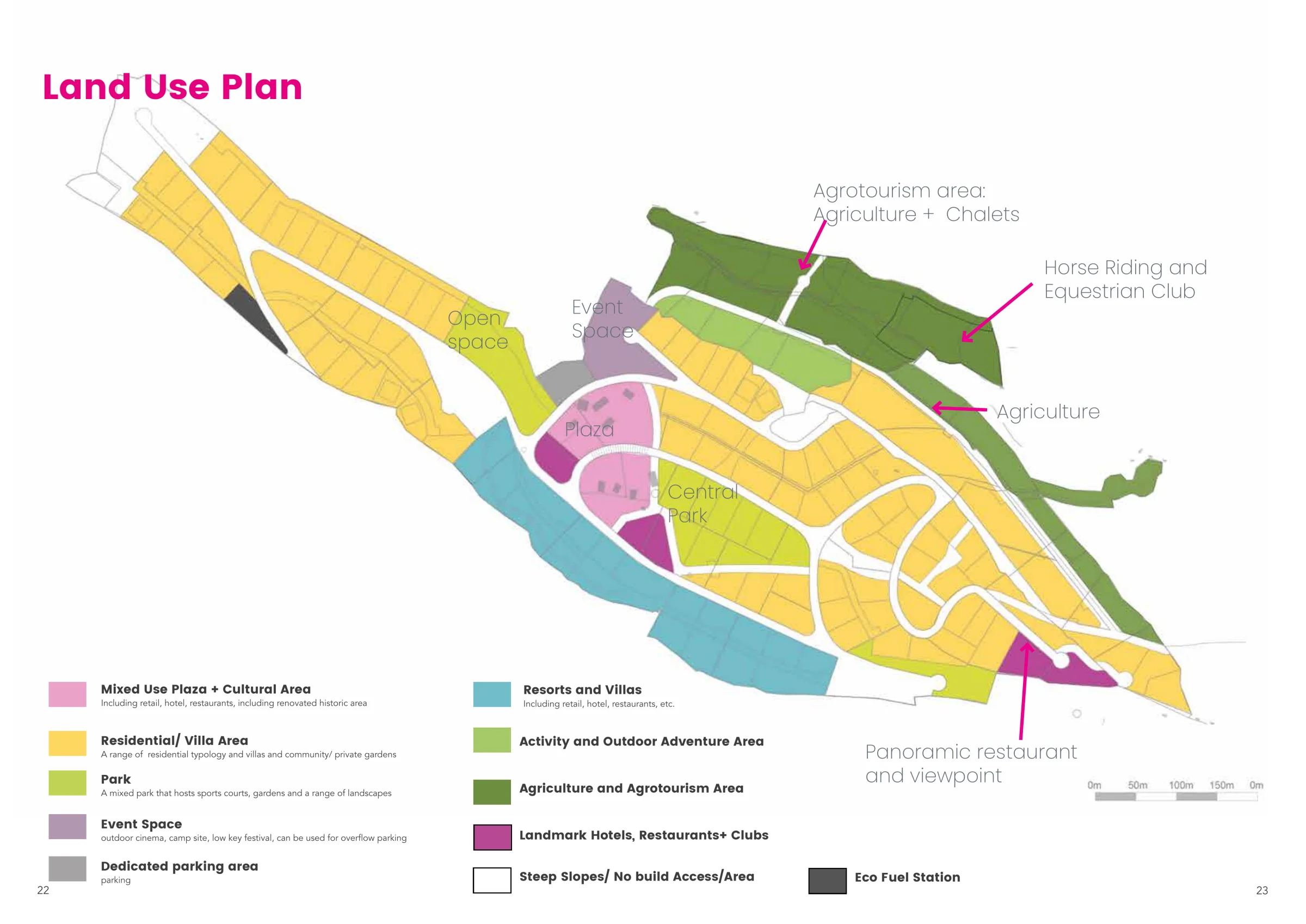
The plan brings together residential, mixed use, park, event, resort, activity, agriculture, and landmark uses.
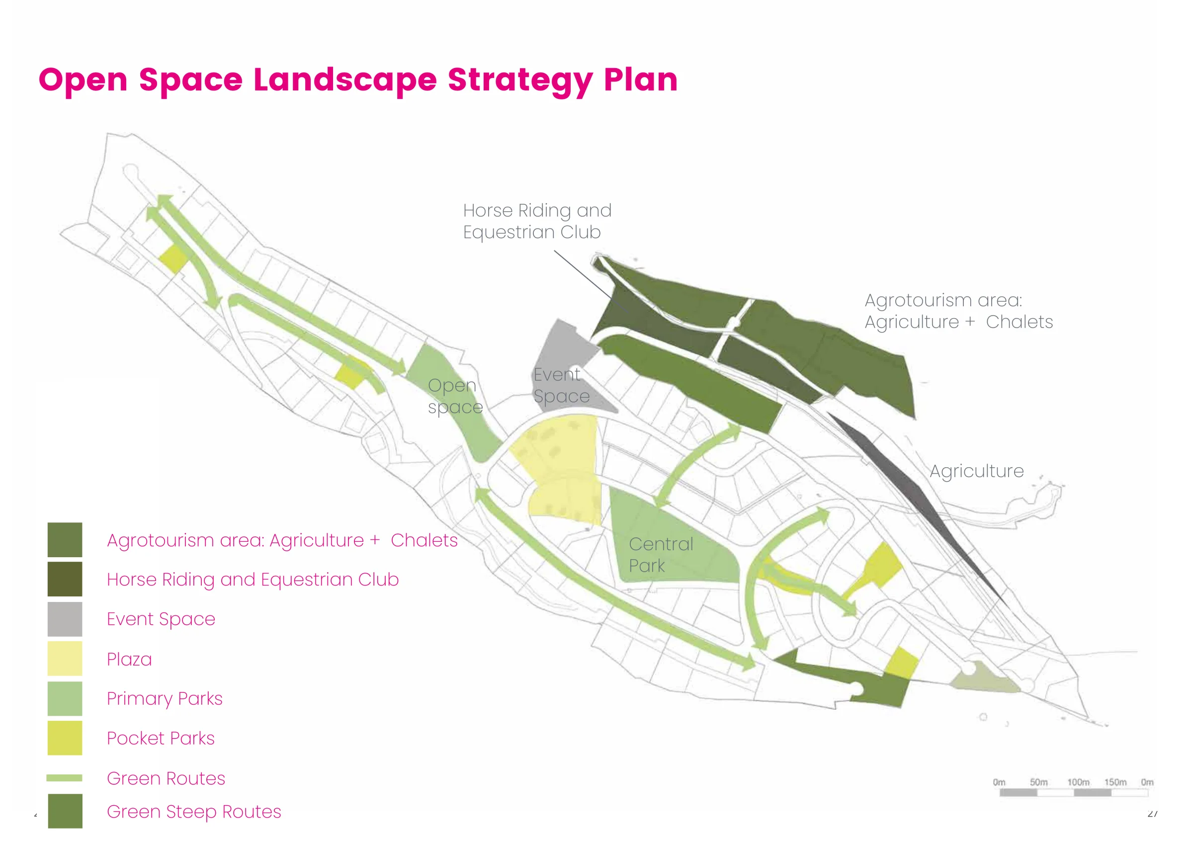
Primary parks, pocket parks, green routes, and steep green routes connect the central park with outer open spaces.
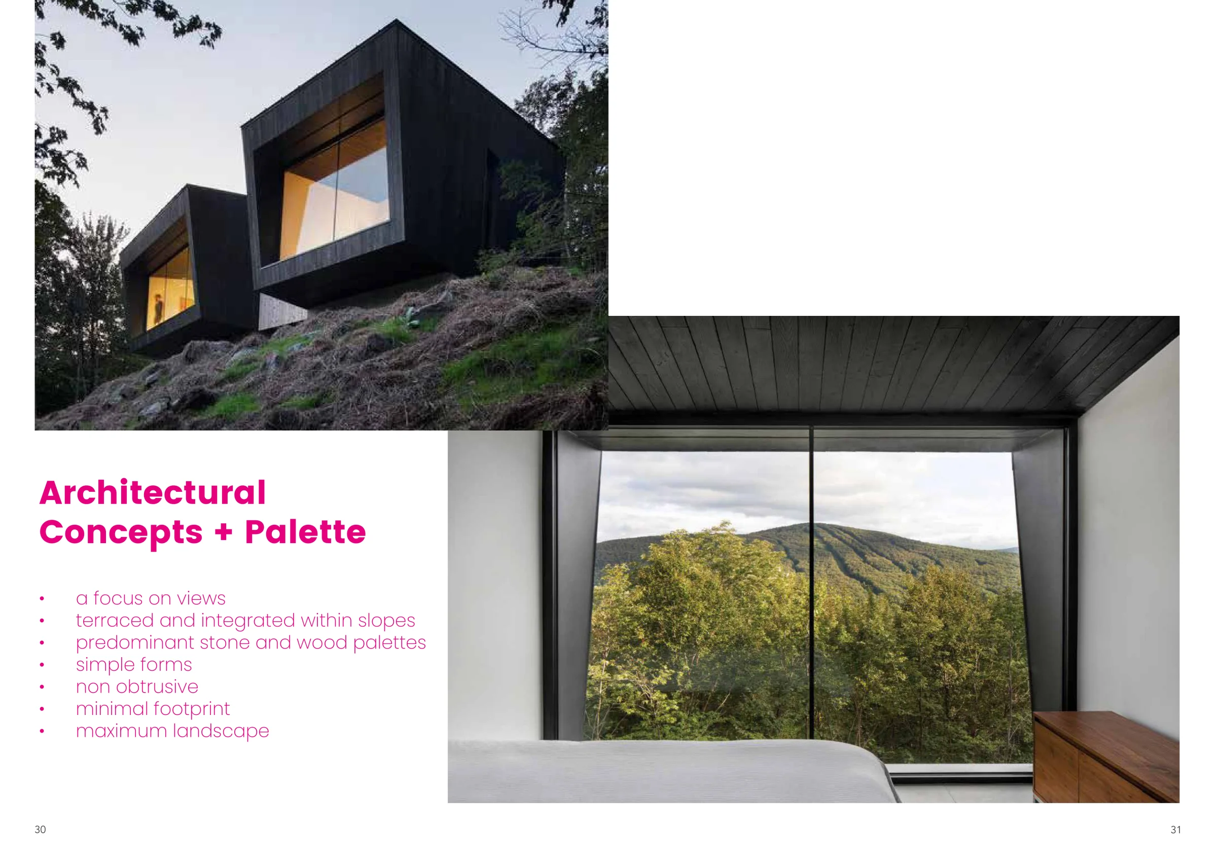
Views, stone, wood, simple forms, and a minimal footprint define the architectural direction.